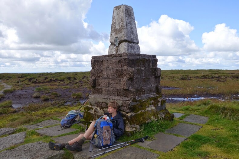
Saturday, 9 August 2014

Reflections of a grandfather

Official Distance: 150 miles (as the crow flies) / 251 miles (Long Distance Walkers Association) / 256 miles (Pennine Way Association) / 268 miles (National Trail) / 270 miles (Wainwright) / 280 miles (what we did, with extras, measured on the map)
Total ascent: 32,000 feet

I've noticed at the end of previous trail walks that my metabolism and appetite change noticeably -  during the walk carbohydrate intake goes up, drinking becomes compulsive. It's now two days since we finished and, mercifully, all seems to be returning to normal. Even the aching tiredness is fading. What is left is a great sense of achievement. The fells have been climbed and navigated - mostly - successfully. The organisation all worked and the distance was covered. The electronics of posting a nightly blog was perhaps the most challenging part, as the combination of tablet and poor or non-existent WiFi and 3G networks conspired against us. Another time, no blog....
The over-riding memory was of wonderful, wonderful hill walking. If you love moors and fells, hidden valleys and rivers, this is the walk for you. It was a bit surprising how few PW walkers we met. There has been a fantastic investment in the path over the last 50 years (yes, its half-century will be celebrated next year, and there will be a TV programme to enjoy). So, if you are sufficiently fit and hill-savvy, get out and enjoy it.
We were greatly encouraged by the kindness of our sponsors and their messages of encouragement (especially those enjoining Tom to look after his Grandfather, which he did!). We were welcomed by kindly hosts for our overnight stays. We also had superb support from Jean, the family and friends, including my amazingly memorable birthday party!
Tom and Adam, Old Silent Inn
Above all, I'm grateful to Tom for his company, for stopping countless times to let me catch up and for putting up with my bad jokes.
People ask, "What was your best moment?" That's impossible to answer in one reply, so here is a selection of the things which I personally greatly enjoyed.

Ancient trackways

Tom on the Roman road at Blackstone Edge - the route at least is Roman, although the paving may be more recent

This is a packhorse route, near Lower Gorple Reservoir

Archaeology and landscape history

Up on the tops, stuff lasts in the landscape.
One of countless boundary markers

In addition to Hadrian's Wall, there are huge Roman sites, only accessible on foot, such as Whitley Castle and the vast fort at Chew Green on Dere Street.
You can see the ramparts of a huge fort (Chew Green) on the skyline, middle distance - believe me!
The eye of faith may be needed even more here, but this is Dere Street, marching northwards into Pict land!

The great open skies of Northumberland

Always a favourite of mine!
Click on this to enlarge, and fill your lungs with the fresh clean air!
Especially with a celebratory bottle of Harviestoun beer on the top of The Cheviot!

Friday, 8 August 2014

Day 19 - The Last Day (Cocklawfoot - Kirk Yetholm)

The weather, thankfully, was beautiful all day; not too hot, and not too cold, withoccasional cloud,but mostly sunny.

We set off at about 9:45, and made it back up to the path in just over an hour. We reached the top of Cairn Hill soon after, and decided to take the detour to the top of the Cheviot, the highest point on he walk. We stopped for a snack up there, and enjoyed the sense of achievement it brought.
We then walked mack down, and along to a mountain refuge hut, where we had lunch. We admired the view from the hut as we sat on the porch; a beautiful vista of the surrounding landscape in the sun.
The rest of the day passed uneventful, and we made it into Kirk Yetholm unharmed, and very, very relieved.


Wednesday, 6 August 2014

Day 18 (Byrness - Cocklaw Foot)

The climb out of Byrness proved to be a steep climb, described by our host as "Up a bit, Down a bit, over a forest track, and up onto the moors." We made it, however, in the end, and stood with a wonderful view of Byrness and the wonderful wooded valley.

It was cloudy throughout the morning, with the occasional shower. We made it to a mountain refuge hut in time for lunch just as a particularly bad shower passed over. The sun came out as we ate, and we continued on happily until the next shower...

and the next one...

and the next one...

There were clear outlines of an old roman fort which we passed during the morning, with a wonderful set of ramparts. John was very enthusiastic, as ever, about this. Most of the day was spent going in and out of rain, cloud, and sunshine. In the sun, we had spectacular views into Scotland to the North, and England to the South.


The view coming down to Cocklaw Foot was also, very nice. We turned down there, off the Pennine Way, in order to split the Cheviot Hills into two sixteen mile days, rather than one twenty-seven miles day. We were picked up by Jean Asher, my granny, and driven to Kirk Yetholm, where we will be spending two nights, before driving home on Friday morning.

Tuesday, 5 August 2014

Day 17 (Bellingham - Byrness)


Distance: 16 miles
Cumulative: 246.5
Gates: 11
Stiles: 12

We set off in the sun after a night in one of the nicest guest houses at which we've had the pleasure of staying. The weather was beautiful, and we made good progress over the moors. We stopped for lunch on the hill before w entered Keilder woods, having picked up fresh sandwiches from the Bellingham Bakery.

The clouds rolled over our heads as we entered the woods, but id did not begin to rain. The path through the forest was little more than a boggy track to start with, but the rest of the route after fifiteen minutes or so was on a gravel road, meaning we could make lots of headway and were in Byrness by 4:00.

The Forest View Inn in Byrness was ideal accomodation for walkers and bikers alike - being in a great, quiet location, only ten minutes from Keilder, it served good food morning and night. The staff were all friendly, and even  took our boots from us as we arrived, brushed them off, and dried them for us.

All in all, a good day.

Monday, 4 August 2014

Day 16 (Twice Brewed - Bellingham)

Distance: 17
Cumulative: 235.5
Gates: 32
Stiles: 41

Breakfast at the Twice Brewed Inn was good, and it fuelled us back up to the Wall and our path in the morning. Our only hindrance being in having to stop to put on rain gear, as we experienced a half hour long shower - thankfully our only one today.

We made good time along the wall, stopping for photos at Sycamore Gap:
Soon after the gap, we turned north once again, and didn't stop all the way through Wark Forrest until we had our lunch on some rocks on the northern side of Wark Burn.

The beautiful Northumberland countryside proved a wonderful place for the afternoon's walk, and we arrived an hour or so ahead of schedule in Bellingham for a warm greeting at the Lyndale B&B, and a stand up meal at the Cheviot Hotel.


Sunday, 3 August 2014

Day 15 (Knaresdale - Twice Brewed)

Distance: 18 miles
Cumulative: 218.5
Gates: 40
Stiles: 47

We set off at 8:15 this morning, after a lovely night's sleep in Knaresdale. The rain held off as we climbed over the first moor, and it wasn't until half way up to the next that we had to put on our rain gear.
The route rises over Hartleyburn Common, following the line of the Maiden Way (rt. centre)
For most of the morning it was raining to the west, but not over us!

 My (Tom's) right ankle has been aching since we passed Alston yesterday, and it turns out that the tendons on the front of it are swollen. Still, I soldiered on, but by the end of today, I was walking with a limp, and my right foot angled in.

Looking across the South Tyne valley towards Haltwhistle

When the rain met us at about 12:30, it came in short, sharp squalls, and continued to do so throughout the day. Because of this, we spent a good deal of time putting on, and taking off our jackets.
The Walltown Crags - Hadrian's Wall in sight!

We arrived at the Twice Brewed Inn at 6:00 ish, and enjoyed a great meal. We read as we waited for our meals, John, the Economist, and I, The Perks of Being a Wallflower (for the second time).


Saturday, 2 August 2014

Day 14 Garrigill to Knarsdale

Distance: 12.5 miles
Cumulative: 200.5 miles
Gates: 49
Stiles: 28

Anne Bramwell and her husband have kept the Post Office at Garrigill for 50 years! They did do well for us, especially drying our saturated clothing. The forecast was for the morning rain to die out, leaving a dry window between 10 and 3. We left at 10, waking briskly above, and sometimes alongside, the beautiful South Tyne.
The South Tyne north of Garrigill

Rain was never far away, so cagoules were on and off. In the interest of speed we gave the delights of Alston a miss.
Alston
The whistle of the steam railway punctuated the morning drizzle, and we were rewarded with a sighting.
The South Tynedale Railway, north of Alston
Sadly we had to whistle past Whitley Castle, a Roman fort with spectacular earthworks, which was built about the same time as the Wall, to protect the Roman's lead and silver mines in the area. Must go back!
We also saw a much richer bird life: oyster catcher, lapwing, heron, swallows and wagtail. In a lull in the drizzle we had lunch at Thornhopeburn, sitting on the course of the Maiden Way, the Roman road linking Kirkby Thore in Westmorland with the fort at Cavoran, near the wall. From Slaggyford the route follows a stretch of the South Tyne Way, the track bed of the old Alston line. Here the heavens opened so that, despite our best efforts and arriving before 3, we arrived sodden once again! Fortunately Les and Margaret Graham are retired farmers, and Margaret quickly organised drying and a warm welcome.

Friday, 1 August 2014

Day 13 (Dufton - Garrigill)

Distance: 15 miles
Cumulative: 188 miles
Gates: 21
Stiles: 4
Leaving Dufton
We set out in high spirits, trying to cover as much ground as possible before the rain set in. We reached the tops of Knock Old Man and Great Dun Fell in low cloud, but not too much rain. It was as we sat eating some sandwiches at 12 ish that the drizzle turned into a downpour.
We made it up and over Cross Fell alright, but took a wrong turn somewhere on the way down - the visibility was poor and we hadn't a waterproof map. We descended what we thought was the track of the Pennine Way, returned out to be a bridleway into Kirkland, a village about 7 miles from where we had set off.
Garrigill Post Office and B&B - wonderfully kind!
We decided that it was not worth the climb, and so we headed along the road to Skirwith, where we phoned the owners of the B&B in Garrigill. They offered to come and pick us up. We travelled the rest of the way by car.
Village Green, Garrigill
We met our friend John in Garrigill, who had to be rescued from the fells. The man from our baggage transfer company, Brigantes, said that many people get lost on Cross Fell, as the cairns are incredibly misleading, and guide countless people off the hill in the wrong direction.