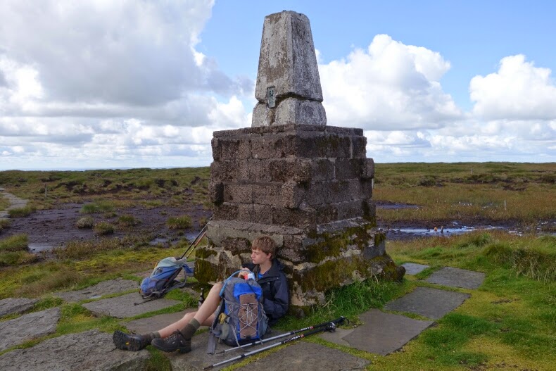
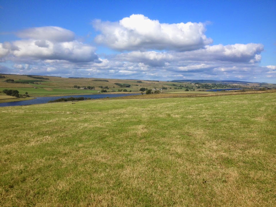
Saturday, 9 August 2014

Reflections of a grandfather

Official Distance: 150 miles (as the crow flies) / 251 miles (Long Distance Walkers Association) / 256 miles (Pennine Way Association) / 268 miles (National Trail) / 270 miles (Wainwright) / 280 miles (what we did, with extras, measured on the map)
Total ascent: 32,000 feet

I've noticed at the end of previous trail walks that my metabolism and appetite change noticeably -  during the walk carbohydrate intake goes up, drinking becomes compulsive. It's now two days since we finished and, mercifully, all seems to be returning to normal. Even the aching tiredness is fading. What is left is a great sense of achievement. The fells have been climbed and navigated - mostly - successfully. The organisation all worked and the distance was covered. The electronics of posting a nightly blog was perhaps the most challenging part, as the combination of tablet and poor or non-existent WiFi and 3G networks conspired against us. Another time, no blog....
The over-riding memory was of wonderful, wonderful hill walking. If you love moors and fells, hidden valleys and rivers, this is the walk for you. It was a bit surprising how few PW walkers we met. There has been a fantastic investment in the path over the last 50 years (yes, its half-century will be celebrated next year, and there will be a TV programme to enjoy). So, if you are sufficiently fit and hill-savvy, get out and enjoy it.
We were greatly encouraged by the kindness of our sponsors and their messages of encouragement (especially those enjoining Tom to look after his Grandfather, which he did!). We were welcomed by kindly hosts for our overnight stays. We also had superb support from Jean, the family and friends, including my amazingly memorable birthday party!
Tom and Adam, Old Silent Inn
Above all, I'm grateful to Tom for his company, for stopping countless times to let me catch up and for putting up with my bad jokes.
People ask, "What was your best moment?" That's impossible to answer in one reply, so here is a selection of the things which I personally greatly enjoyed.

Ancient trackways

Tom on the Roman road at Blackstone Edge - the route at least is Roman, although the paving may be more recent

This is a packhorse route, near Lower Gorple Reservoir

Archaeology and landscape history

Up on the tops, stuff lasts in the landscape.
One of countless boundary markers

In addition to Hadrian's Wall, there are huge Roman sites, only accessible on foot, such as Whitley Castle and the vast fort at Chew Green on Dere Street.
You can see the ramparts of a huge fort (Chew Green) on the skyline, middle distance - believe me!
The eye of faith may be needed even more here, but this is Dere Street, marching northwards into Pict land!

The great open skies of Northumberland

Always a favourite of mine!
Click on this to enlarge, and fill your lungs with the fresh clean air!
Especially with a celebratory bottle of Harviestoun beer on the top of The Cheviot!

Friday, 8 August 2014

Day 19 - The Last Day (Cocklawfoot - Kirk Yetholm)

The weather, thankfully, was beautiful all day; not too hot, and not too cold, withoccasional cloud,but mostly sunny.

We set off at about 9:45, and made it back up to the path in just over an hour. We reached the top of Cairn Hill soon after, and decided to take the detour to the top of the Cheviot, the highest point on he walk. We stopped for a snack up there, and enjoyed the sense of achievement it brought.
We then walked mack down, and along to a mountain refuge hut, where we had lunch. We admired the view from the hut as we sat on the porch; a beautiful vista of the surrounding landscape in the sun.
The rest of the day passed uneventful, and we made it into Kirk Yetholm unharmed, and very, very relieved.


Wednesday, 6 August 2014

Day 18 (Byrness - Cocklaw Foot)

The climb out of Byrness proved to be a steep climb, described by our host as "Up a bit, Down a bit, over a forest track, and up onto the moors." We made it, however, in the end, and stood with a wonderful view of Byrness and the wonderful wooded valley.

It was cloudy throughout the morning, with the occasional shower. We made it to a mountain refuge hut in time for lunch just as a particularly bad shower passed over. The sun came out as we ate, and we continued on happily until the next shower...

and the next one...

and the next one...

There were clear outlines of an old roman fort which we passed during the morning, with a wonderful set of ramparts. John was very enthusiastic, as ever, about this. Most of the day was spent going in and out of rain, cloud, and sunshine. In the sun, we had spectacular views into Scotland to the North, and England to the South.


The view coming down to Cocklaw Foot was also, very nice. We turned down there, off the Pennine Way, in order to split the Cheviot Hills into two sixteen mile days, rather than one twenty-seven miles day. We were picked up by Jean Asher, my granny, and driven to Kirk Yetholm, where we will be spending two nights, before driving home on Friday morning.

Tuesday, 5 August 2014

Day 17 (Bellingham - Byrness)


Distance: 16 miles
Cumulative: 246.5
Gates: 11
Stiles: 12

We set off in the sun after a night in one of the nicest guest houses at which we've had the pleasure of staying. The weather was beautiful, and we made good progress over the moors. We stopped for lunch on the hill before w entered Keilder woods, having picked up fresh sandwiches from the Bellingham Bakery.

The clouds rolled over our heads as we entered the woods, but id did not begin to rain. The path through the forest was little more than a boggy track to start with, but the rest of the route after fifiteen minutes or so was on a gravel road, meaning we could make lots of headway and were in Byrness by 4:00.

The Forest View Inn in Byrness was ideal accomodation for walkers and bikers alike - being in a great, quiet location, only ten minutes from Keilder, it served good food morning and night. The staff were all friendly, and even  took our boots from us as we arrived, brushed them off, and dried them for us.

All in all, a good day.

Monday, 4 August 2014

Day 16 (Twice Brewed - Bellingham)

Distance: 17
Cumulative: 235.5
Gates: 32
Stiles: 41

Breakfast at the Twice Brewed Inn was good, and it fuelled us back up to the Wall and our path in the morning. Our only hindrance being in having to stop to put on rain gear, as we experienced a half hour long shower - thankfully our only one today.

We made good time along the wall, stopping for photos at Sycamore Gap:
Soon after the gap, we turned north once again, and didn't stop all the way through Wark Forrest until we had our lunch on some rocks on the northern side of Wark Burn.

The beautiful Northumberland countryside proved a wonderful place for the afternoon's walk, and we arrived an hour or so ahead of schedule in Bellingham for a warm greeting at the Lyndale B&B, and a stand up meal at the Cheviot Hotel.


Sunday, 3 August 2014

Day 15 (Knaresdale - Twice Brewed)

Distance: 18 miles
Cumulative: 218.5
Gates: 40
Stiles: 47

We set off at 8:15 this morning, after a lovely night's sleep in Knaresdale. The rain held off as we climbed over the first moor, and it wasn't until half way up to the next that we had to put on our rain gear.
The route rises over Hartleyburn Common, following the line of the Maiden Way (rt. centre)
For most of the morning it was raining to the west, but not over us!

 My (Tom's) right ankle has been aching since we passed Alston yesterday, and it turns out that the tendons on the front of it are swollen. Still, I soldiered on, but by the end of today, I was walking with a limp, and my right foot angled in.

Looking across the South Tyne valley towards Haltwhistle

When the rain met us at about 12:30, it came in short, sharp squalls, and continued to do so throughout the day. Because of this, we spent a good deal of time putting on, and taking off our jackets.
The Walltown Crags - Hadrian's Wall in sight!

We arrived at the Twice Brewed Inn at 6:00 ish, and enjoyed a great meal. We read as we waited for our meals, John, the Economist, and I, The Perks of Being a Wallflower (for the second time).


Saturday, 2 August 2014

Day 14 Garrigill to Knarsdale

Distance: 12.5 miles
Cumulative: 200.5 miles
Gates: 49
Stiles: 28

Anne Bramwell and her husband have kept the Post Office at Garrigill for 50 years! They did do well for us, especially drying our saturated clothing. The forecast was for the morning rain to die out, leaving a dry window between 10 and 3. We left at 10, waking briskly above, and sometimes alongside, the beautiful South Tyne.
The South Tyne north of Garrigill

Rain was never far away, so cagoules were on and off. In the interest of speed we gave the delights of Alston a miss.
Alston
The whistle of the steam railway punctuated the morning drizzle, and we were rewarded with a sighting.
The South Tynedale Railway, north of Alston
Sadly we had to whistle past Whitley Castle, a Roman fort with spectacular earthworks, which was built about the same time as the Wall, to protect the Roman's lead and silver mines in the area. Must go back!
We also saw a much richer bird life: oyster catcher, lapwing, heron, swallows and wagtail. In a lull in the drizzle we had lunch at Thornhopeburn, sitting on the course of the Maiden Way, the Roman road linking Kirkby Thore in Westmorland with the fort at Cavoran, near the wall. From Slaggyford the route follows a stretch of the South Tyne Way, the track bed of the old Alston line. Here the heavens opened so that, despite our best efforts and arriving before 3, we arrived sodden once again! Fortunately Les and Margaret Graham are retired farmers, and Margaret quickly organised drying and a warm welcome.

Friday, 1 August 2014

Day 13 (Dufton - Garrigill)

Distance: 15 miles
Cumulative: 188 miles
Gates: 21
Stiles: 4
Leaving Dufton
We set out in high spirits, trying to cover as much ground as possible before the rain set in. We reached the tops of Knock Old Man and Great Dun Fell in low cloud, but not too much rain. It was as we sat eating some sandwiches at 12 ish that the drizzle turned into a downpour.
We made it up and over Cross Fell alright, but took a wrong turn somewhere on the way down - the visibility was poor and we hadn't a waterproof map. We descended what we thought was the track of the Pennine Way, returned out to be a bridleway into Kirkland, a village about 7 miles from where we had set off.
Garrigill Post Office and B&B - wonderfully kind!
We decided that it was not worth the climb, and so we headed along the road to Skirwith, where we phoned the owners of the B&B in Garrigill. They offered to come and pick us up. We travelled the rest of the way by car.
Village Green, Garrigill
We met our friend John in Garrigill, who had to be rescued from the fells. The man from our baggage transfer company, Brigantes, said that many people get lost on Cross Fell, as the cairns are incredibly misleading, and guide countless people off the hill in the wrong direction.

Thursday, 31 July 2014

Day 12 (Langdon Beck - Dufton)

Distance: 13.5 miles
Cumulative: 173 miles
Gates: 26
Stiles: 5

We set off early following the river and went past the Langdon Beck hotel where we had had anexcellent meal last night. The route left the map for what looked like a short and innocous loop. Unfortunately there was a poorly signed turn off the obvious path which we missed so we ended up slighty lost. I have a great app called Tom'sTrails which gives you the grid reference of your current position. From this Tom worked out where we probably were in the white margin of the map and we soon regained the u path.

A steady climb alongside the river led to Cauldron Snout waterfall and from there the track went up onto the moor. Sadly the discrete stone slabs that were once there to help you over the wet ground have been replaced by an ugly rubble track. This seems a great shame, especially in an area of such beauty and wildness. The only explanation we could come up with was that it has been done to improve access to the moor for grouse shooting.

 We were truely impressed by High Cup Nick. I don't think my picture does justice to this enourmous and unexpected rent in the hill side. If you haven't been here yet i would suggest adding it to your bucket list. The walk to it is shorter from Dufton but for the full dramatic effect you should approach as we dud from Teesdale.

Sadly this will be my last contribution to the blog as Nick has arrived with John to take Finn and I home. Tom and I have already been talking about which walk he might do next year, and if invited Finn and I will be keen to join him!

Wednesday, 30 July 2014

Day 11 (Clove Lodge - Langdon Beck)

Distance: 15 miles 
Cumulative: 159.5 miles
Gates: 42
Stiles: 48
Red letter day today. We finally managed to get the cream tea we have been searching for since we left Malham. The Conduit Tea Room in Middleton in Teesdale didn't disappoint....and the rock cakes were great too. 
The Cream Tea
Clearly we avoided being trampled to death by Baldersdale cows. Having left Clove Lodge we walked past the house where Hannah Hauxwell lived, farming without mechanical aids, running water or electricity until 1988. She was the subject of a fascinating BBC documentary . The route followed the Tees upstream passing Low Force and High Force. 

Low Force
Tom and Finn at High Force
Dale B&B is lovely, and we highly recommend tea at the Langdon Beck Hotel. I will be so sad to leave Tom tomorrow and head back to the real world and work. 
Meg.
 

Tuesday, 29 July 2014

Day 10 (Tan Hill to Clove Lodge)

Distance: 17 miles 
Cumulative: 144.5
Gates: 25
Stiles: 19
We set off at a good pace down from the Tan Hill Inn, over mercifully dry peat moorland passing numerous grouse butts. I was glad to be the right side of the glorious 12th (is it the 12th?).
Tom at the half-way point on the Pennine Way (or thereabouts!)
We were off the moor after 2 hours and reckoned at that rate we would be at the B&B by two. This seemed a touch early so we decided to take the alternative and slightly longer route via Bowes. In my mind Bowes was quite a big place with that splendid museum where we were bound to be able to get a cream tea to celebrate the half way point of the walk. Unfortunately that place is actually Barnard Castle another 4 miles in the wrong direction and there is nothing in Bowes except a ruined castle. We marked the occasion instead with the end of an oft melted bar of chocolate Caitlin had left for us. 
Bowes Castle
We continued on the alternative route over Cotherstone Moor to Baldersdale. 
A little rest....

We had been warned about some killer cows here by friends who did the walk last year and only narrowly escaped with their lives by vaulting a barbed wire topped wall. Fortunately we didn't encounter any cows and arrived safely at Clove Lodge, possibly the most beautiful B&B ever. You will have to wait until tomorrow to see if we can get out of Baldersdale in one piece....
Baldersdale
 

Monday, 28 July 2014

Day 9 (Hardraw to Tan Hill)


Distance: 16 miles
Cumulative: 127.5
Gates: 22
Stiles: 11

Today we set off from Hardraw, and having agreed to partake in this day of the walk I was not informed that in fact today's route included the largest amount ascent of the whole walk. We then, obviously, began up a hill with the morning sun on our backs. Not being a walker we only got several hundred meters before I had to take off my boots and treat two blisters. 
The first blister
We continued to hike on until we reached the first of many summits for our elevenses, only for Tom to open up his ruck sack and say "I wasn't given any food today....". 
Field barns near Thwaite
We continued on towards Keld, and my spirits rose when I saw I sign that claimed Keld, our lunch destination, was only 2 miles away. After possibly the longest two miles of my life, I limped into Keld, abandoned even by dog, at the back. 
Finn swimming near Keld
I agreed to continue on the premis that Tom gallantly carried my rucksack, and we set off toward Tan Hill. Despite popular belief I made it to top, and the spectacular views made it all worth while. 
The Tan Hill Inn comes into view
The food was fantastic and the day was made by a hot shower. 

Contributed reluctantly by Caitlin

Sunday, 27 July 2014

Day 8 (Horton-in-Ribblesdale to Hardraw)

Distance: 16 miles
Cumulative: 111.5 miles
Gates: 15
Stiles: 35


Great news! The blue towel has been reunited with its owner. Adam's hunch was right that the towel was doing the Pennine Way. 
We set off from Horton at about 09.15. Passing Calf Holes pothole brought back fond memories of many freshers' weekends. It is an ideal introduction to caving in the Dales and has seen many hapless groups of ill-dressed 18 year olds passing through. Some instant converts to the sport and some who probably still have to sleep with their bedroom light on as a consequence of the trip. 


A couple of hours later as we started up Cam Fell we heard footsteps behind us - our acquaintances from Fountains Fell and the owner of the now-famous blue towel. His delight at being reunited with his trusty walking companion was obvious. They were indeed walking the Pennine Way, but in short sections over time as work allowed. 
The walk over Cam High Road and down into Hawes was lovely. We spent a while trying to work out all the different geological features we could see and I wished I had concentrated more when I was testing Caitlin during her revision for AS geography earlier in the summer. After a pot of tea, banana milk shake and a ice cream in Hawes we wandered along the river to Hardraw. There was a folk festival in full swing with a great atmosphere, the rooms were lovely too. 

We had a quick look at the waterfall soon after we arrived. Caitlin, Finn and Nick are due to join us for tea.

Saturday, 26 July 2014

Day 7 (Malham to Horton-in-Ribblesdale)

Distance: 15 miles
Cumulative: 95.5 miles
Gates: 24
Stiles: 10
Finlay, Tom and Adam, posting a parcel of books before setting off (don't ask!)
As you can see, we like to count - miles, stiles, gates, etc. It was a particularly hot walk today, I think 24 degrees. We left Malham at half past nine, after beans on toast (I don't recall how many) and arrived in Horton at four in the afternoon. The peaks numbered two. But on a long-distance walk it's always the people you meet along the way that you remember, and on my only stint on the Pennine Way the encounters were few, but they stand out. We (the rear guard, I mean, being me and my mum - Tom, the seasoned walker and taker of no prisoners faintly visible bestride the skyline) were overtaken by two men with daypacks and leather boots on the south face of Fountains Fell - hardly the north face of the Eiger, but we were taking our time nonetheless. They were friendly in passing, but we didn't stop to say much, and at the summit we passed them again, in search of a spot for lunch. They finished theirs first and began the descent as we were still eating. We didn't see them again until Pen-y-ghent, where we both arrived roughly simultaneously at the trig point. The sun was high by then, and despite the fair breeze our throats were dry. Our spaniel Finlay, who will probably appear in future entries, collapsed in the long grass, and we followed suit. It was as one of our friends, as I think of them now, though we only met briefly - in fact I hope that Tom and the ongoing party will run into them again - it was as he dropped to the ground, enjoying his exhaustion, and his partner laughed, 'That'll be him now, not bad at 62,' that I got a sense of a long friendship, the sort of thing that long-distance walks seem to celebrate. He offered to take our photo, and then they headed off. On the way down we recognized at the side of the lane a small hand-towel that had hung from the back of one of their packs. We picked it up, and mum will take it with her tomorrow as they make their way to Hardraw. I hope it can be returned. (Contributed by Adam)
Adam passing Malham Tarn
 
Adam, Finlay, Meg and Tom on the top of Pen-y-ghent


Thursday, 24 July 2014

Day 6 (Gargrave to Malham)

Distance: 7 miles
Cumulative: 80.5 miles
Gates: 26
Stiles: 15


 Another bright, sunny day, but fortunately a short one! At Gargrave we met up with three of Tom's friends from school - Ben Cooper, Smith Middleton and Jacob Jackson - who were to walk the stage with us. The road ran through shady woods to start, then onto Craven farm land where making hay and silage was in full swing.

We crossed Eshton Moor before joining the Aire and had elevenses sitting by the river at Newfield Bridge. Then gently up the stream to Airton, with its imposing converted Mill.
Hanlith provided a steep little climb to a lovely shaded lunch spot above the weir, in sight of Malham.
The morning's walk had been a complete delight!
Day's end in Malham